


Alloway township voting district 3, Salem County, New Jersey
About
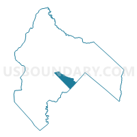
Outline

Summary
| Unique Area Identifier | 621914 |
| Name | Alloway township voting district 3 |
| County | Salem County |
| State | New Jersey |
| Area (square miles) | 8.01 |
| Land Area (square miles) | 7.95 |
| Water Area (square miles) | 0.06 |
| % of Land Area | 99.28 |
| % of Water Area | 0.72 |
| Latitude of the Internal Point | 39.53575850 |
| Longtitude of the Internal Point | -75.32884270 |
Maps


Graphs
Select a template below for downloading or customizing gragh for Alloway township voting district 3, Salem County, New Jersey


Neighbors
Neighoring Voting District (by Name) Neighboring Voting District on the Map
- Alloway township voting district 1, Salem County, NJ
- Alloway township voting district 2, Salem County, NJ
- Hopewell township voting district 1, Cumberland County, NJ
- Quinton township voting district 2, Salem County, NJ
- Stow Creek township voting district 1, Cumberland County, NJ
Top 10 Neighboring County Subdivision (by Population) Neighboring County Subdivision on the Map
- Hopewell township, Cumberland County, NJ (4,571)
- Alloway township, Salem County, NJ (3,467)
- Quinton township, Salem County, NJ (2,666)
- Stow Creek township, Cumberland County, NJ (1,431)
Top 10 Neighboring Place (by Population) Neighboring Place on the Map
Top 10 Neighboring Elementary School District (by Population) Neighboring Elementary School District on the Map
- Hopewell Township School District, NJ (5,087)
- Alloway Township School District, NJ (3,467)
- Quinton Township School District, NJ (2,666)
- Stow Creek Township School District, NJ (1,431)
Top 10 Neighboring Secondary School District (by Population) Neighboring Secondary School District on the Map
Top 10 Neighboring State Legislative District Lower Chamber (by Population) Neighboring State Legislative District Lower Chamber on the Map
Top 10 Neighboring State Legislative District Upper Chamber (by Population) Neighboring State Legislative District Upper Chamber on the Map
Top 10 Neighboring 111th Congressional District (by Population) Neighboring 111th Congressional District on the Map
Top 10 Neighboring Census Tract (by Population) Neighboring Census Tract on the Map
- Census Tract 106, Cumberland County, NJ (5,087)
- Census Tract 212.01, Salem County, NJ (3,450)
- Census Tract 212.02, Salem County, NJ (2,666)
- Census Tract 105, Cumberland County, NJ (2,235)